
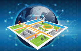
The Power of Geospatial Data Analysis
Geospatial data analysis is a powerful tool that enables us to gain valuable insights by visualising and interpreting data in a geographic context. By combining location information with other datasets, we can uncover patterns, trends, and relationships that are not immediately apparent in traditional data analysis.
One of the key benefits of geospatial data analysis is its ability to provide a spatial perspective on various phenomena. Whether it’s analysing population distribution, monitoring environmental changes, or planning infrastructure development, geospatial analysis allows us to understand how different factors interact within a specific geographical area.
Businesses across various industries are increasingly turning to geospatial data analysis to make informed decisions and drive growth. Retailers use location-based data to identify optimal store locations and target specific customer segments effectively. Emergency services utilise geospatial analysis to improve response times and resource allocation during crises.
Furthermore, advancements in technology, such as Geographic Information Systems (GIS) and remote sensing, have revolutionised the way we collect and analyse geospatial data. These tools enable us to process vast amounts of spatial information efficiently and derive meaningful insights that support decision-making processes.
In conclusion, geospatial data analysis offers a unique perspective that enhances our understanding of complex systems and phenomena. By harnessing the power of location-based information, we can unlock new opportunities for innovation, sustainability, and growth across various sectors.
Nine Benefits of Geospatial Data Analysis: Driving Efficiency, Innovation, and Informed Decision-Making
- Enhances decision-making by providing a spatial context to data.
- Facilitates better resource allocation and planning based on geographic insights.
- Improves efficiency in various industries, such as logistics and urban planning.
- Enables targeted marketing strategies by understanding location-specific trends.
- Supports environmental monitoring and management through spatial data analysis.
- Helps identify patterns and correlations that may not be evident in traditional data analysis.
- Enhances emergency response capabilities by visualising critical information geospatially.
- Empowers businesses to optimise operations and streamline processes with location-based insights.
- Drives innovation and fosters sustainable development through informed spatial decision-making.
Challenges in Geospatial Data Analysis: Complexity, Cost, Privacy, Accuracy, and Integration
Enhances decision-making by providing a spatial context to data.
Geospatial data analysis enhances decision-making by providing a spatial context to data. By incorporating location information into the analysis process, organisations can gain valuable insights into how different variables interact within specific geographical areas. This spatial perspective enables more informed and strategic decision-making, allowing businesses to identify patterns, trends, and relationships that may not be evident through traditional data analysis methods. Ultimately, leveraging geospatial data analysis empowers decision-makers to make more accurate and effective choices that align with the unique characteristics of different locations.
Facilitates better resource allocation and planning based on geographic insights.
Geospatial data analysis plays a crucial role in facilitating better resource allocation and planning by providing valuable geographic insights. By integrating location-based information with other datasets, organisations can identify optimal areas for resource deployment, infrastructure development, and service provision. This enables more efficient decision-making processes, ensuring that resources are allocated where they are most needed based on a thorough understanding of the geographic context. Ultimately, geospatial data analysis empowers businesses and governments to plan strategically and allocate resources effectively to maximise impact and achieve sustainable growth.
Improves efficiency in various industries, such as logistics and urban planning.
Geospatial data analysis plays a crucial role in enhancing efficiency across industries like logistics and urban planning. By utilising location-based information, businesses can optimise route planning, fleet management, and supply chain operations in the logistics sector. In urban planning, geospatial analysis helps city authorities make informed decisions regarding infrastructure development, land use allocation, and disaster management. This pro of geospatial data analysis not only streamlines processes but also leads to cost savings and improved resource allocation, ultimately driving productivity and sustainability in these key sectors.
Enables targeted marketing strategies by understanding location-specific trends.
Geospatial data analysis empowers businesses to develop targeted marketing strategies by gaining insights into location-specific trends. By leveraging geographical information, companies can identify regional preferences, behaviours, and demographics, allowing them to tailor their marketing campaigns effectively to specific locations. Understanding these location-specific trends enables businesses to reach their target audience more accurately, increasing the effectiveness of their marketing efforts and ultimately driving better results and ROI.
Supports environmental monitoring and management through spatial data analysis.
Geospatial data analysis plays a crucial role in supporting environmental monitoring and management by providing valuable insights through spatial data analysis. By integrating location information with environmental datasets, this approach enables us to track changes in ecosystems, identify areas of concern, and develop targeted strategies for conservation and sustainable resource management. Geospatial data analysis empowers environmental professionals to make informed decisions based on a spatial perspective, ultimately contributing to the preservation of our natural world for future generations.
Helps identify patterns and correlations that may not be evident in traditional data analysis.
Geospatial data analysis offers a distinct advantage by uncovering patterns and correlations that may remain hidden in traditional data analysis methods. By integrating location information with other datasets, geospatial analysis enables us to identify spatial relationships and trends that provide valuable insights for decision-making. This unique capability allows us to gain a deeper understanding of complex phenomena and make more informed choices based on a comprehensive view of the data within a geographic context.
Enhances emergency response capabilities by visualising critical information geospatially.
Geospatial data analysis plays a crucial role in enhancing emergency response capabilities by visualising critical information geospatially. By incorporating location-based data into emergency planning and response strategies, authorities can gain a comprehensive understanding of the geographical context of incidents, enabling them to make informed decisions quickly and efficiently. This spatial perspective allows for better resource allocation, improved coordination among response teams, and ultimately, more effective and timely responses to emergencies.
Empowers businesses to optimise operations and streamline processes with location-based insights.
Geospatial data analysis empowers businesses to optimise operations and streamline processes by providing valuable location-based insights. By leveraging geospatial information, companies can make informed decisions about resource allocation, logistics planning, and customer targeting. This strategic use of location data not only enhances operational efficiency but also enables businesses to adapt quickly to changing market conditions and maximise productivity.
Drives innovation and fosters sustainable development through informed spatial decision-making.
Geospatial data analysis drives innovation and fosters sustainable development by empowering informed spatial decision-making. By leveraging location-based information, organisations can identify opportunities for growth, optimise resource allocation, and plan more efficiently. This strategic approach not only enhances operational effectiveness but also promotes environmental sustainability and social equity. Through the insights gained from geospatial data analysis, businesses and policymakers can make well-informed decisions that drive innovation, support sustainable development goals, and create a positive impact on society as a whole.
Complexity
Geospatial data analysis poses a significant challenge in terms of complexity, as it demands specialised skills and expertise to interpret and manipulate the data effectively. The intricate nature of geospatial datasets, coupled with the need to understand spatial relationships and geographic information systems (GIS), can create barriers for individuals without the necessary training or experience. This complexity can lead to potential errors in analysis and decision-making if not handled by professionals with a deep understanding of geospatial data processing techniques.
Cost
Implementing geospatial analysis tools and acquiring high-quality spatial datasets can pose a significant financial challenge for businesses and organisations. The cost associated with setting up the necessary infrastructure, licensing software, and procuring accurate geospatial data can be substantial, especially for smaller enterprises with limited budgets. This financial barrier may deter some organisations from fully leveraging the benefits of geospatial data analysis, potentially hindering their ability to make informed decisions based on location-based insights.
Data Privacy Concerns
Geospatial data analysis presents a significant con in the form of data privacy concerns. The nature of geospatial data, which frequently includes sensitive location information, gives rise to valid worries about data security and appropriate usage. As this data can reveal individuals’ movements and habits, there is a heightened risk of privacy breaches and potential misuse if not handled with the utmost care and adherence to stringent privacy protocols. Organizations utilising geospatial data must prioritise robust measures to safeguard individuals’ privacy rights and ensure responsible handling of location-based information.
Data Accuracy
Data Accuracy is a significant con of geospatial data analysis. Inaccurate or outdated geospatial data can undermine the integrity of the analysis process, potentially leading to erroneous conclusions and decisions. When the data used in geospatial analysis is not up-to-date or contains inaccuracies, it can distort the interpretation of results and misguide decision-making. This issue highlights the importance of ensuring the quality and reliability of geospatial data to maintain the credibility and effectiveness of analysis outcomes.
Integration Challenges
Integration Challenges: Integrating geospatial data with existing systems or software applications may pose technical challenges that require expertise to overcome. One of the main drawbacks of geospatial data analysis is the complexity involved in seamlessly incorporating spatial information into pre-existing infrastructure. This process often demands specialised knowledge and resources to ensure compatibility and smooth data flow between different systems. Without the necessary expertise, organisations may face obstacles in utilising geospatial data effectively, hindering their ability to leverage location-based insights for informed decision-making.