

Exploratory Spatial Data Analysis: Unveiling Patterns in Geography
Exploratory Spatial Data Analysis (ESDA) is an essential component of geographic data analysis, focusing on identifying patterns, anomalies, and relationships within spatial data. By using various statistical and visualisation techniques, ESDA helps researchers and analysts understand complex spatial phenomena and make informed decisions.
Understanding ESDA
ESDA involves the examination of spatial data sets to uncover underlying structures or patterns. Unlike traditional data analysis, which often assumes independence between observations, spatial data analysis recognises that geographic phenomena are inherently interconnected. This interconnectedness is captured through concepts such as spatial autocorrelation and spatial heterogeneity.
Key Techniques in ESDA
The toolkit for ESDA includes a variety of methods designed to explore and visualise spatial relationships:
- Spatial Autocorrelation: This technique measures the degree to which similar values occur near each other in space. The Moran’s I statistic is commonly used to quantify spatial autocorrelation.
- Spatial Clustering: Identifying clusters or hotspots within a dataset can reveal areas with unusually high or low values. Techniques like Local Indicators of Spatial Association (LISA) help in detecting these clusters.
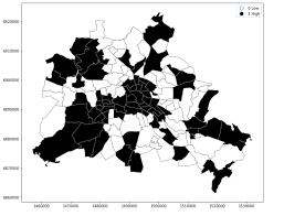
- Thematic Mapping: Visual representations such as choropleth maps allow analysts to see the distribution of variables across different regions, highlighting patterns that might not be evident from raw data alone.
- Kriging and Interpolation: These geostatistical methods predict values at unsampled locations by leveraging the spatial correlation among sampled points.
The Importance of ESDA
ESDA plays a crucial role across various fields including urban planning, environmental science, public health, and more. By revealing hidden patterns in spatial data, it aids policymakers in resource allocation, risk assessment, and strategic planning. For instance, identifying disease clusters through ESDA can help public health officials target interventions more effectively.
Challenges in ESDA
Despite its benefits, ESDA faces several challenges. The complexity of spatial relationships can lead to difficulties in model selection and interpretation. Additionally, issues such as scale dependency require careful consideration when analysing results. Analysts must also be cautious about overfitting models due to the inherent interdependence of spatial data points.
The Future of ESDA
The future of Exploratory Spatial Data Analysis looks promising with advancements in technology and computational power. The integration of machine learning techniques with traditional ESDA methods is opening new avenues for more sophisticated analyses. Furthermore, the increasing availability of geospatial data from sources like satellites and mobile devices provides rich datasets for exploration.
In conclusion, Exploratory Spatial Data Analysis remains an indispensable tool for understanding geographical phenomena. As technology evolves and datasets grow larger and more complex, the role of ESDA will continue to expand, offering deeper insights into our world’s intricate spatial dynamics.
Uncovering Insights: The Benefits of Exploratory Spatial Data Analysis
- Reveals hidden patterns and relationships within spatial data.
- Provides insights for informed decision-making in various fields like urban planning and public health.
- Helps in identifying spatial clusters and hotspots of interest.
- Enables visualisation of geographic data through thematic mapping techniques.
- Aids in resource allocation and strategic planning by understanding spatial autocorrelation.
- Integrates advanced statistical methods with geographic information to enhance analysis capabilities.
Challenges in Exploratory Spatial Data Analysis: Complexity, Scale Dependency, Model Selection, and Overfitting Risk
Reveals hidden patterns and relationships within spatial data.
One significant advantage of exploratory spatial data analysis is its ability to unveil hidden patterns and relationships within spatial data. By employing various statistical techniques and visualisation tools, ESDA can uncover intricate connections that may not be immediately apparent from raw data. This insight allows researchers and analysts to gain a deeper understanding of spatial phenomena, leading to more informed decision-making processes in fields such as urban planning, environmental science, and public health.
Provides insights for informed decision-making in various fields like urban planning and public health.
Exploratory Spatial Data Analysis (ESDA) offers a significant advantage by providing valuable insights that support informed decision-making across diverse fields such as urban planning and public health. By uncovering spatial patterns and relationships within data, ESDA enables urban planners to identify optimal locations for infrastructure development and resource allocation. In the realm of public health, ESDA can pinpoint disease clusters, aiding in the efficient deployment of healthcare resources and targeted interventions to prevent the spread of illnesses. Ultimately, the insights derived from ESDA empower decision-makers to make strategic choices that positively impact communities and enhance overall well-being.
Helps in identifying spatial clusters and hotspots of interest.
One significant advantage of Exploratory Spatial Data Analysis is its ability to identify spatial clusters and hotspots of interest within a dataset. By utilising techniques such as Local Indicators of Spatial Association (LISA), ESDA can pinpoint areas with unusually high or low values, revealing patterns that may not be immediately apparent. This capability is invaluable in various fields, from urban planning to epidemiology, as it enables researchers and policymakers to focus resources and interventions on specific geographical areas where they are most needed, ultimately leading to more targeted and effective decision-making.
Enables visualisation of geographic data through thematic mapping techniques.
One significant advantage of exploratory spatial data analysis is its ability to facilitate the visualisation of geographic data using thematic mapping techniques. By employing methods such as choropleth maps, analysts can effectively represent the distribution of variables across different regions, allowing for the identification of spatial patterns and trends that may not be apparent from raw data alone. This visualisation approach enhances understanding and interpretation of complex spatial relationships, enabling researchers and decision-makers to gain valuable insights into geographical phenomena for informed decision-making and strategic planning.
Aids in resource allocation and strategic planning by understanding spatial autocorrelation.
Exploratory Spatial Data Analysis offers a significant advantage in aiding resource allocation and strategic planning by leveraging the understanding of spatial autocorrelation. By identifying patterns of similarity or dissimilarity in spatial data, ESDA enables decision-makers to allocate resources more effectively where they are most needed. This insight into spatial autocorrelation helps in optimising strategies for targeted interventions, infrastructure development, and policy implementation, ultimately leading to more efficient and informed decision-making processes.
Integrates advanced statistical methods with geographic information to enhance analysis capabilities.
By integrating advanced statistical methods with geographic information, exploratory spatial data analysis enhances analysis capabilities by providing a deeper understanding of spatial relationships and patterns. This approach allows researchers and analysts to not only explore traditional statistical measures but also consider the geographical context in which data points are situated. By incorporating spatial information into statistical models, ESDA enables more accurate and insightful interpretations of complex spatial phenomena, leading to more informed decision-making processes in various fields such as urban planning, environmental management, and public health.
Complexity
One significant drawback of Exploratory Spatial Data Analysis (ESDA) is the inherent complexity of spatial relationships, which can pose challenges in both modelling and interpretation. Spatial data often exhibit intricate patterns and dependencies that may not be easily captured by traditional statistical methods. The interconnectivity of spatial observations can lead to complexities such as scale dependency and non-stationarity, making it difficult to develop accurate models that effectively represent the underlying spatial processes. Furthermore, interpreting the results of ESDA analyses requires a deep understanding of spatial statistics and may involve subjective judgement, adding another layer of complexity to the process.
Scale Dependency
One significant drawback of Exploratory Spatial Data Analysis is scale dependency, where the outcomes of ESDA may differ depending on the scale of analysis. This con introduces a challenge as the interpretation and conclusions drawn from ESDA results can be inconsistent across different spatial scales. The variation in results based on scale can complicate decision-making processes and hinder the ability to derive reliable and robust insights from the data. It underscores the importance of carefully considering and addressing scale-related issues in ESDA to ensure that the findings are meaningful and applicable across various spatial contexts.
Model Selection
When it comes to exploratory spatial data analysis, one significant challenge lies in model selection. The complexity of spatial data, with its inherent interconnectedness and spatial autocorrelation, adds a layer of difficulty in choosing the most suitable models for analysis. Traditional statistical methods may not always be sufficient to capture the nuances of spatial relationships accurately. This con highlights the importance of carefully considering the unique characteristics of spatial data and the potential impact of spatial autocorrelation when selecting models for ESDA, emphasising the need for specialised techniques and a deep understanding of geographic patterns.
Overfitting Risk
One significant drawback of Exploratory Spatial Data Analysis (ESDA) is the risk of overfitting models due to the interdependence of spatial data points. The intricate spatial relationships within datasets can make it challenging to strike a balance between capturing genuine patterns and fitting noise. When models are overfitted, they may perform well on the existing data but struggle to generalise to new, unseen data, resulting in misleading or inaccurate conclusions. This overfitting risk underscores the importance of careful model selection and validation in ESDA to ensure that findings are robust and reliable.